What Happened to FATMAP?
If you've been searching for a FATMAP replacement, you're not alone. For years, FATMAP was the leading app for backcountry skiing and outdoor adventures, offering high-resolution 3D maps, detailed route planning, and vital terrain analysis tools. Launched in 2016, it became the go-to platform for off-piste explorers.
In 2023, Strava acquired FATMAP, promising to integrate its powerful features into the Strava app. Unfortunately, this didn’t happen. On October 1, 2024, FATMAP was officially shut down, leaving the community frustrated and searching for a viable alternative.
If you're one of those adventurers looking for the best FATMAP alternative, OUTMAP is the answer.
Why OUTMAP Is the Best FATMAP Replacement
1. The Most Accurate Winter Imagery (In Beta and Improving Fast)
OUTMAP offers high-resolution winter imagery, perfect for backcountry skiing and snowboarding. While still in beta, coverage is growing quickly, making it the most reliable source for winter navigation.

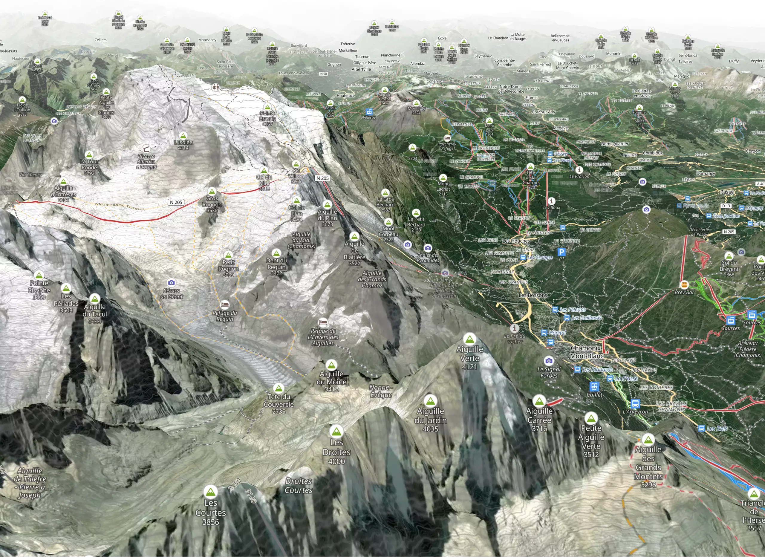
2. High-Precision 3D Maps and Terrain Data
Get access to the most detailed 3D terrain maps available, including:
- Slope angles and aspect
- Avalanche-prone areas
- Real-time elevation profiles
- Custom terrain layers

These advanced tools ensure you have everything you need for safe route planning and navigation.
3. Extensive Backcountry Routes and Skiing Itineraries
OUTMAP comes preloaded with popular ski touring routes, mountain huts, and hidden backcountry gems, making it an essential tool for serious adventurers.

4. Offline Maps for Remote Areas
Download maps for offline use, ensuring you never lose access to vital information—even in areas with no cellular service.
5. A Dedicated and Passionate Team
Our team is made up of outdoor enthusiasts and developers committed to creating the best mapping experience. Frequent updates and a user-focused roadmap make OUTMAP the app that’s constantly evolving.


What's Next for OUTMAP?
The future of OUTMAP is bright, with exciting features planned for release:
1. Browser Version Coming in 2025
A web-based version of OUTMAP is scheduled for release in 2025. It will allow you to plan your itineraries on a desktop, with seamless syncing across devices for easy access on your mobile app.
2. Improved Winter Imagery
We’re working on expanding and enhancing our winter imagery coverage to provide even clearer, more detailed views of your favorite backcountry zones.
3. Community Content and Routes
Inspired by FATMAP’s community-driven approach, OUTMAP will soon feature user-generated content, allowing adventurers to share their own routes, experiences, and local knowledge directly within the app.
Why OUTMAP Is the Ultimate Backcountry Skiing App
If you're looking for:
- 3D maps with high-resolution terrain
- Accurate slope and avalanche data
- Offline map access for remote adventures
- Regular updates and a dedicated development team
Then OUTMAP is the best FATMAP replacement available today.
Download OUTMAP Today
Don’t let the loss of FATMAP hold back your next adventure. Download OUTMAP today and experience the most reliable backcountry skiing app available.
Download for iOS - Download for Android
Your adventure begins with OUTMAP—explore safely and confidently.


