FATMAP may be gone, but detailed 3D terrain exploration doesn’t have to be.
Outmap brings immersive terrain, winter imagery, slope analysis, offline maps, and backcountry routes together in one modern mapping platform.
Looking for a FATMAP Replacement?
For years, FATMAP helped backcountry skiers, snowboarders, mountaineers, and hikers understand complex mountain terrain through detailed 3D maps.
After FATMAP was acquired by Strava, the standalone app was officially discontinued on October 1, 2024. Many of the features its users depended on never made their way into Strava.
Outmap is built for the community FATMAP left behind—with detailed 3D terrain, backcountry planning tools, offline navigation, and a team focused entirely on making mountain maps better.
Features Equivalence
Outmap
FATMAP
App Availability
3D Terrain Visualization
Winter Imagery
Terrain Analysis
overlays
Complex terrain overlays
Avalanche Information
Offline Maps
Backcountry Routes
Web and Mobile Apps
Content sharing
Explore the Mountains in 3D Again
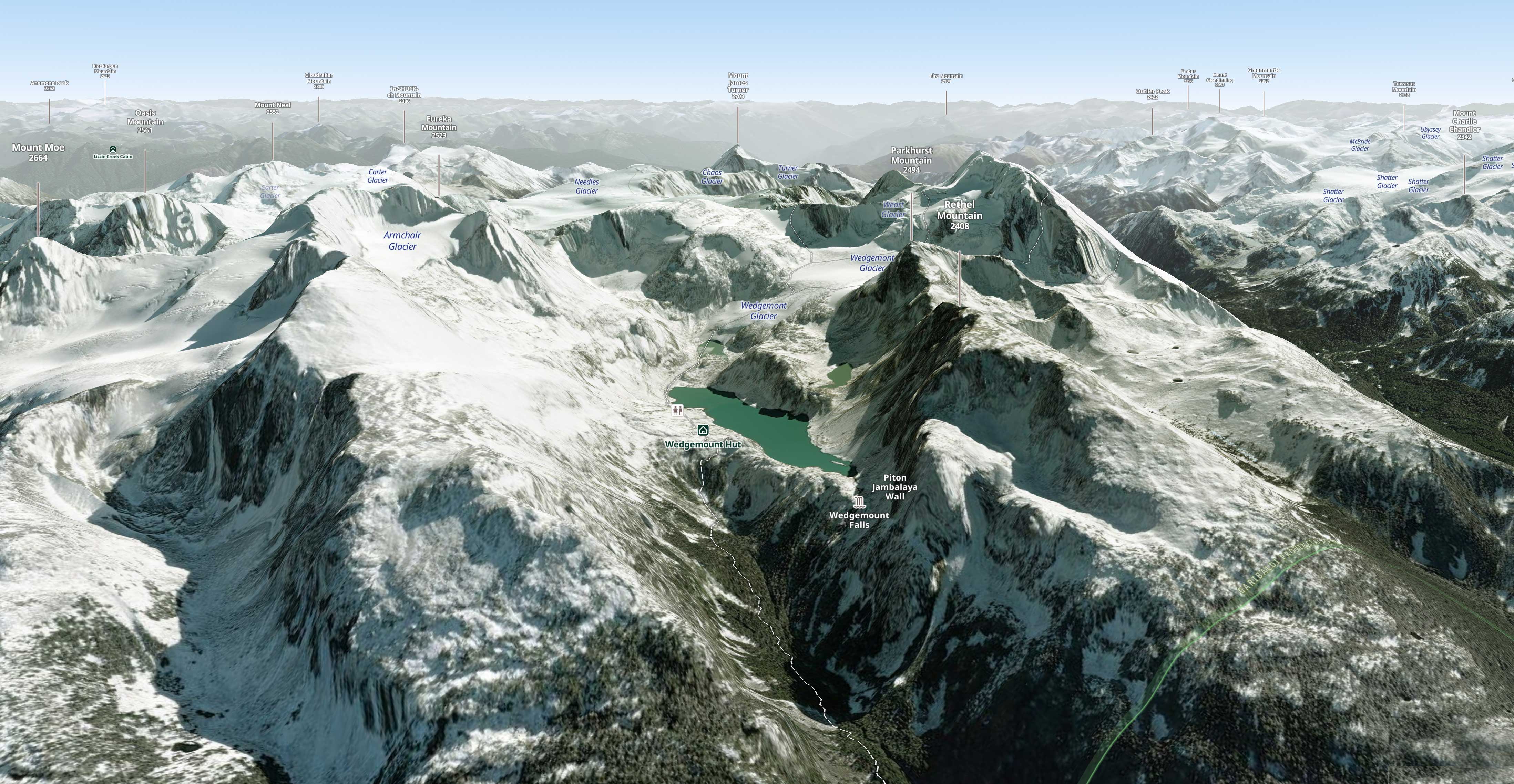
Outmap lets you tilt, rotate, and examine terrain from any angle. Explore ridges, bowls, couloirs, and glaciers before committing to a route.
It brings back the immersive mountain perspective FATMAP users valued, with detailed terrain built for modern backcountry planning.
Built for Winter
Use dedicated layers to examine:
- Slope angle
- Aspect and elevation
- Avalanche terrain
- Winter imagery
- Regional avalanche bulletins
These tools help you understand the terrain and prepare before heading out.
Digital maps are planning aids and should always be used alongside current conditions, avalanche education, and sound judgment.
Winter Imagery and Multiple Map Sources
Summer imagery does not always reveal what matters during winter.
Outmap provides winter imagery in supported regions and lets you switch between several map and satellite sources. This makes it easier to find the clearest view of snowfields, glaciers, ridges, and alpine routes.
Routes, Huts, and Offline Maps
Discover ski-touring routes, mountain huts, and backcountry itineraries directly on the map.
Download detailed areas before leaving and keep using your maps when cellular coverage disappears.
Plan at home. Explore offline.
Built to Carry the FATMAP Experience Forward
Outmap has caught up on many of FATMAP’s essential capabilities:
- Immersive 3D terrain
- Winter imagery
- Slope and aspect overlays
- Avalanche information
- Offline maps
- Backcountry routes
- Multiple imagery sources
And unlike FATMAP, Outmap is actively developed by a team focused on outdoor mapping.
Find Your Next Line
Explore the terrain from every angle, prepare your route, and take your maps offline.