Know the terrain
Each terrain layer answers one question about a slope before you are on it:
- Slope angle: how steep is it? Most slab avalanches start on slopes between 30° and 50°, and rarely below 30°, so steepness is the first thing to check.
- Aspect: which way does it face? Wind and sun change the snow from one aspect to the next, and the avalanche forecast names the aspects where the danger is. Match them with this layer to choose safer slopes.
- Avalanche risk: is it in the danger zone? It groups slope angle into coloured bands, with red for 34° to 45°, where most avalanches release. It shows steepness only; the snow and the weather are in the forecast.
- Flat areas: where does it ease off? It picks out the level, gentler ground among the steeper slopes.
- Elevation bands: how high is it? The layer colours the map by altitude, so you see at a glance how high each slope is. Forecasts rate the danger by elevation: some give a height, such as above 2,000 m, that you can read straight off the layer; others draw the line at treeline, which shifts with the terrain.
With Outmap Pro, Terrain shade shows where the shade falls at a chosen time, and Hours in the Sun shows how much sun each slope gets in a day. Sun changes the snow through the day and shapes when and where wet avalanches happen.
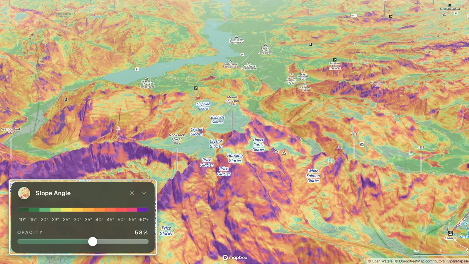
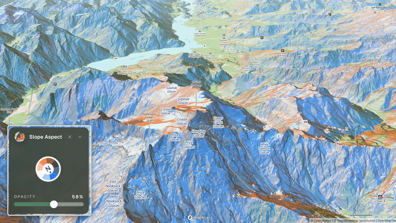
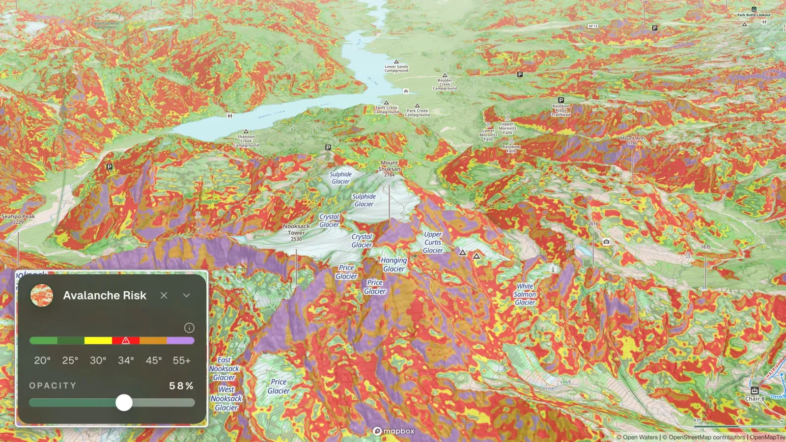
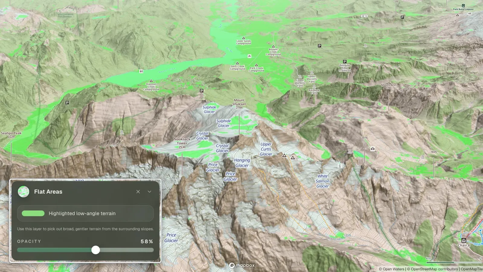
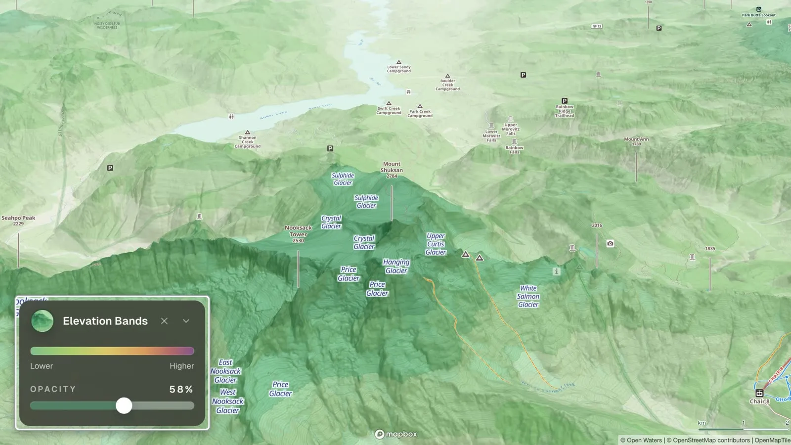
Treat any map as a starting point, expect it to differ from the real slope, and measure in the field, as avalanche.org recommends.
Check the avalanche forecast
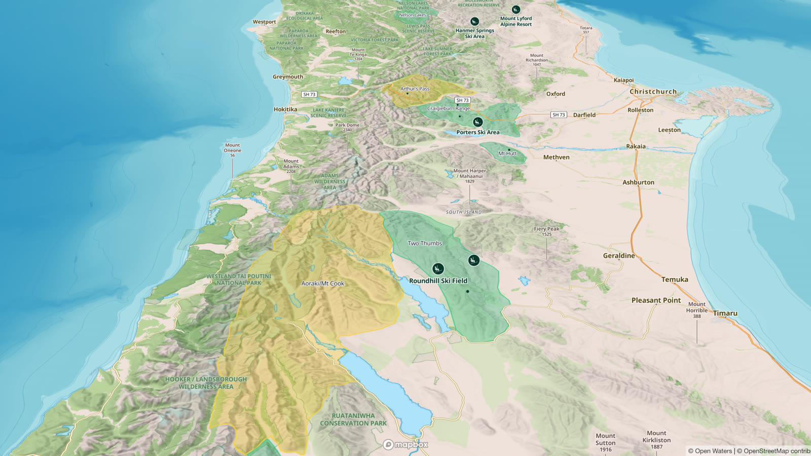
Outmap shows the official avalanche forecast wherever a public bulletin is published, across North America, Europe and New Zealand: the forecast regions, and the latest bulletin for the area you are in. It is free; it needs a connection, since the forecast is not part of offline maps. The ATES overlay rates the terrain itself as simple, challenging or complex, on the Avalanche Terrain Exposure Scale that Avalanche Canada uses. It covers rated zones in Canada and the central Pyrenees so far, and more ATES and Auto-ATES layers are on the way.
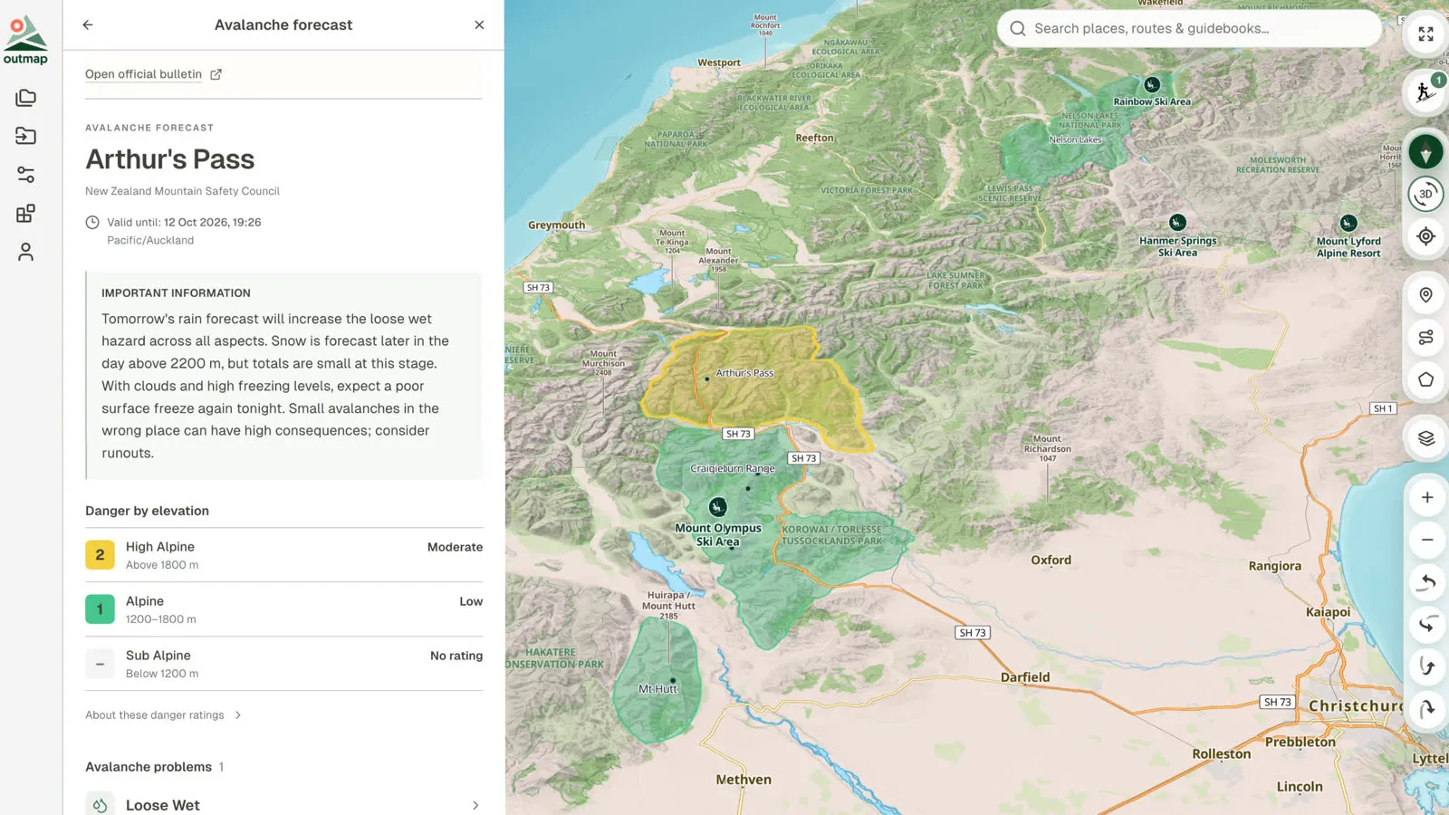
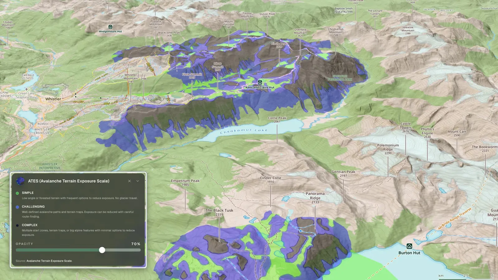
Forecast: Arthur's Pass, New Zealand, from the New Zealand Mountain Safety Council. ATES: the terrain around Whistler, British Columbia, rated simple, challenging or complex.
See it in 3D, and in winter
Tilt and rotate the map in 3D to study a line from every side, on your phone or in Outmap Web. The terrain layers work in 3D too. With Outmap Pro, lay satellite imagery over the terrain, from five sources:
- Maxar: high-resolution satellite imagery.
- Mapbox: a balance of clarity and performance.
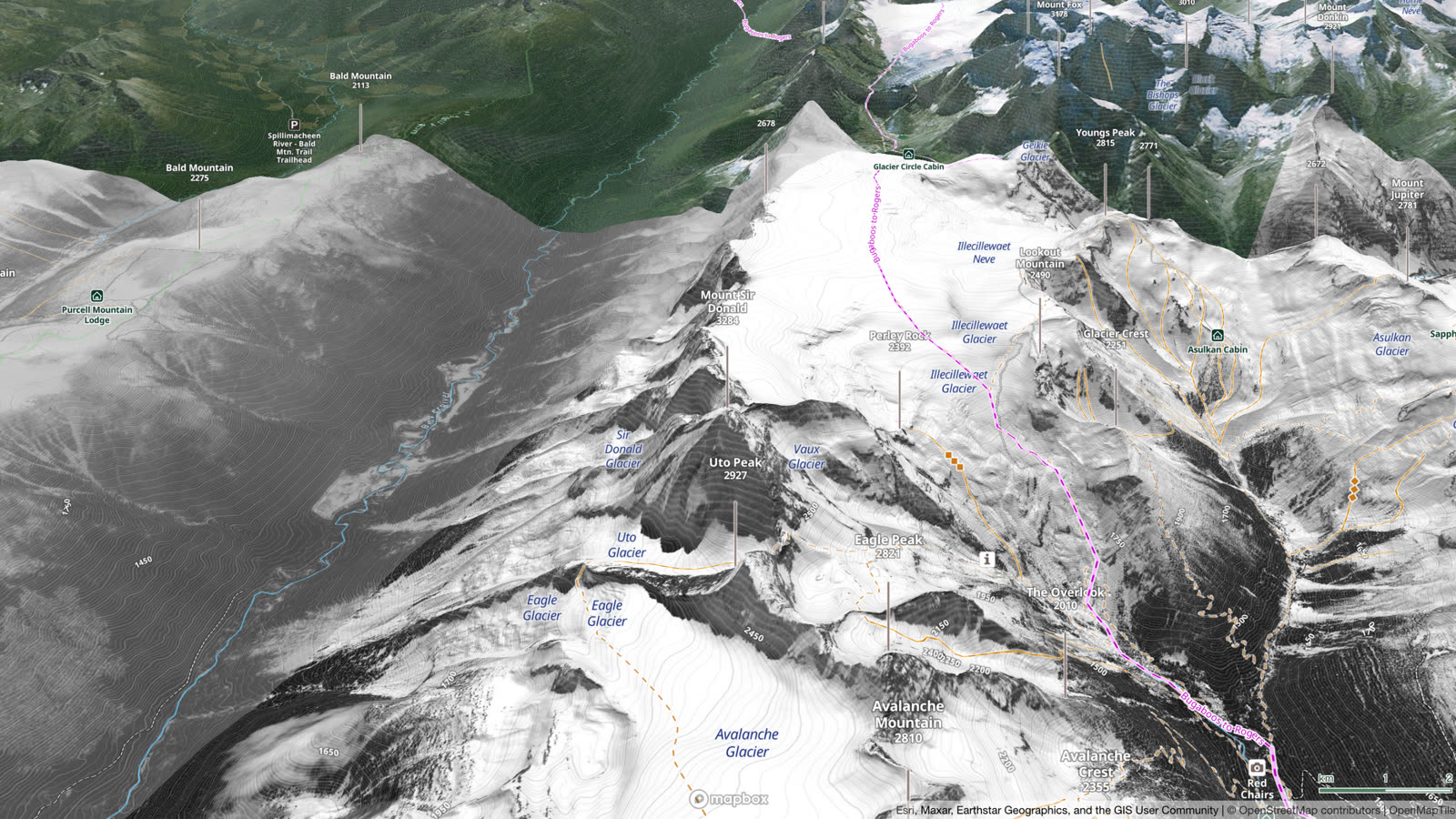
- Winter (beta): snow-focused, high-resolution imagery, so far in British Columbia, Alberta, Japan and parts of Europe. Mont-Blanc is next in line.
- Recent Imagery: the last 30 days, or any month back to June 2015.
- National Imagery: the highest resolution available for each place, from national and regional aerial imagery, with Maxar or Mapbox where there is none.
Freezing level contour lines and a snow coverage layer are coming.
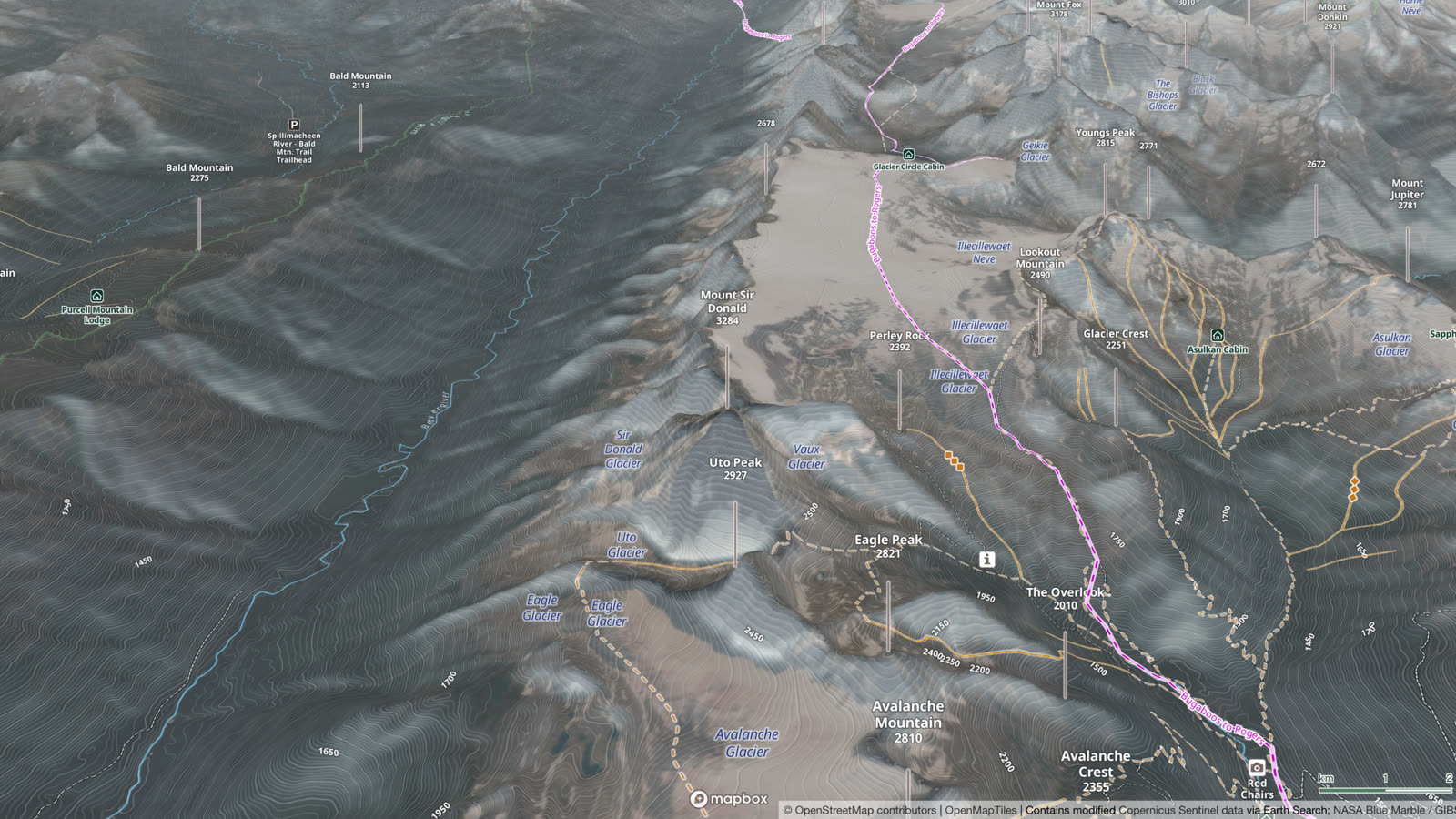
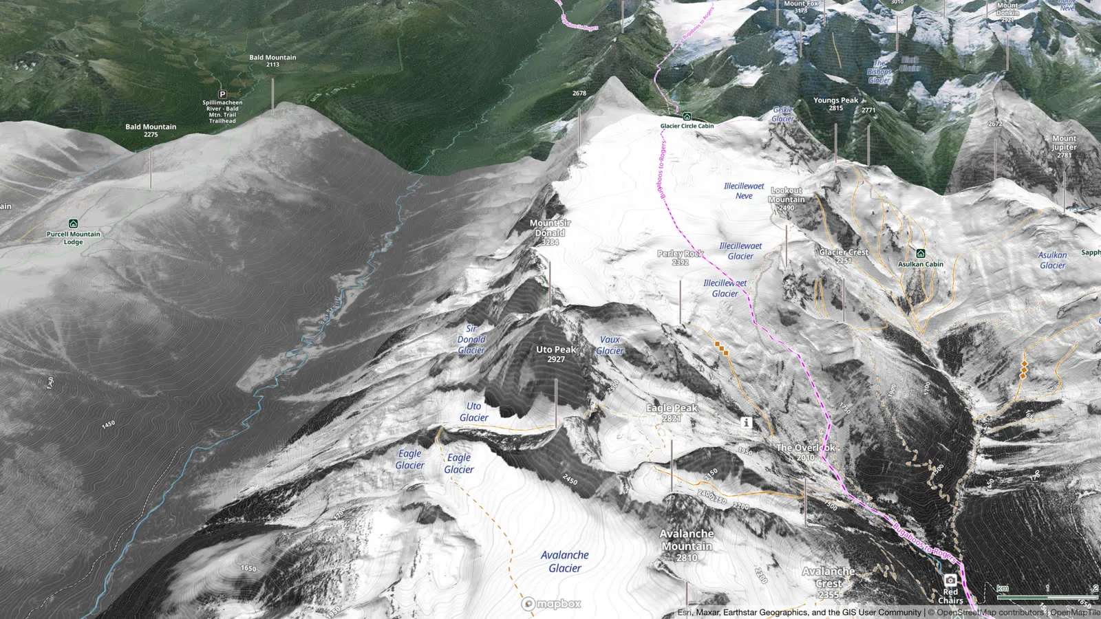
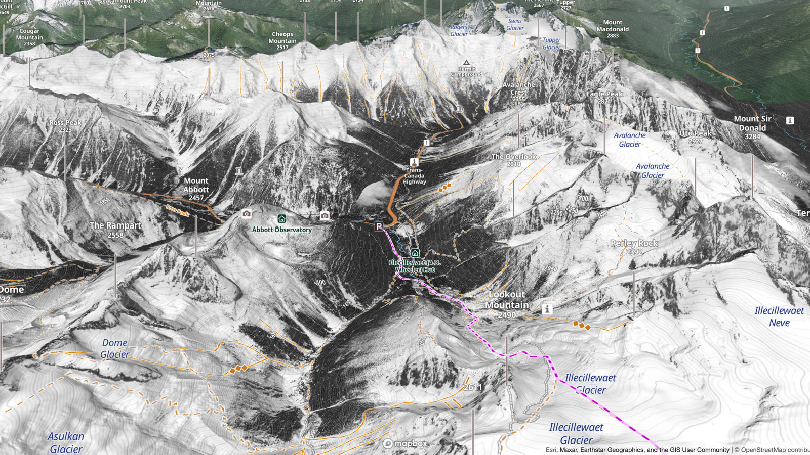
Switch the same slope between summer and winter to see what hides under the snow, such as cliffs and gullies. Below: Rogers Pass, British Columbia, in August, and the same view in the Winter imagery.
Find ski tours
Outmap's guidebooks are curated ski route collections, with more regions coming.
- Great Canadian Ski Traverses: Bugaboos to Rogers, Bonningtons, Wapta, Bow Yoho, Spearhead and Garibaldi Neve.
- Mount Rainier Ski Descents: Tahoma, Washington.
- Cascade River Ski Loops: North Cascades, Washington.
- Mount Washington: New Hampshire.
The Wapta Traverse in the Canadian Rockies, from the Great Canadian Ski Traverses guidebook. Drag the map to look around, or press Fly over to follow the route.
Beyond the guidebooks, the ski trail layer shows touring routes from OpenStreetMap, Skitourenguru and community-sourced data, and the Heatmaps overlay shows the busiest zones, from community data.
Plan your own route
Draw, edit and save routes on your phone or in Outmap Web: follow the trails, and the line snaps to them, or draw straight across untracked terrain. Mark your decision points with waypoints, so you know where to stop and ask: keep going or turn back? The Pointer, the red dot in the middle of the map, shows the height of the spot under it, and the distance and climb or descent to it from where you are. Import and export routes as GPX, KML, KMZ or GeoJSON.
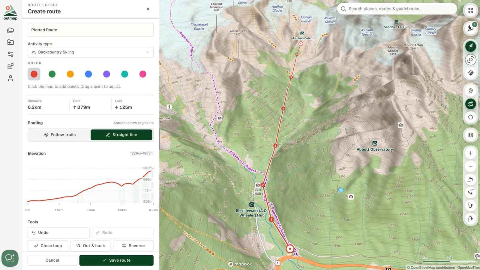
Then look at the whole line from every side: Orbit Around circles the camera around a route or a point, and Fly Over follows the route through the 3D terrain. Both are free.
Go offline
With Outmap Pro, download the area before you leave, and your plan works without cell service:
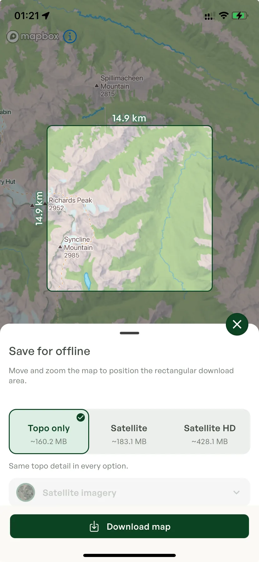
- In the app, open the Layers panel, go to the Offline tab and tap Download map.
- Move and zoom the map until the box frames the area you want to download.
- Choose Topo only, Satellite or Satellite HD. HD stays sharp when you zoom in close, and takes 2 to 3× the space of Satellite.
- Under Terrain layers, make sure the ones you need, such as slope angle, are ticked.
The app shows the size before you download. The download also holds the hillshade, contour lines and guidebooks. Your routes and waypoints are always on your phone.

On the tour
Your position shows on the map as you move, in 3D too. Tap the location button to centre the map on you; double-tap it, and the map turns with your phone, with a blue arrow showing the way you face. If you get turned around, the compass button swings the map back to north. To record your track, tap the + button at the bottom right of the map, then Record track and Start recording.
For guides, patrollers and rescue teams
Outmap's Pro Program is for certified guides, rescue teams, ski patrollers and avalanche professionals, starting with three months free, then discounted licensing, with priority support and early access to new features. Details at outmap.pro/for-professionals.
Frequently asked questions
Yes. Outmap shows the official avalanche forecast wherever a public avalanche bulletin is published, including North America, Europe and New Zealand: the forecast regions, and the latest bulletin for the area you are in. It is free on every plan, and needs a connection: the forecast is not part of offline maps. Avalanche Map
From Outmap's guidebooks, curated ski route collections, and from OpenStreetMap, Skitourenguru and community-sourced route data. Guidebooks
Yes, with Outmap Pro, in beta: high-resolution, snow-focused imagery with good coverage in British Columbia, Alberta and Japan, and in some places in Europe. Where it does not reach yet, including parts of the Alps, you see summer imagery; the Mont-Blanc massif is next. Imagery shows the snow on the day it was taken, so check today's conditions in the avalanche forecast.
Outmap's map works worldwide, with trails from OpenStreetMap, which covers almost any trail in the world. Avalanche forecasts show wherever a public bulletin is published. Winter imagery covers British Columbia, Alberta, Japan and parts of Europe so far, with Mont-Blanc next. ATES ratings cover rated zones in Canada and the central Pyrenees, and the guidebooks cover western Canada, Washington and New Hampshire.
Yes, with Outmap Pro, in the Outmap app for iPhone and Android. Download a region before you go and it keeps the topographic map, hillshade, contour lines, the terrain layers, guidebooks and satellite imagery from Maxar, Mapbox or Winter, so they all work without cell service. Your routes and waypoints are always on your phone, and you stay logged in. Recent Imagery and National Imagery are online only.
Yes. Outmap's free plan includes the topographic basemap, contour lines, 3D maps, custom waypoints and routes, activity recording, single-file GPX, KML, KMZ and GeoJSON import and export, and all five terrain layers: slope angle, slope aspect, avalanche risk, flat areas and elevation bands.
Outmap Pro costs $4.99 a month billed annually, or $7.99 a month month to month, with a 7-day free trial.
Outmap runs on iOS and Android, and on desktop as Outmap Web, which syncs with the app. All three have the same features.
Try Outmap on your next tour
Plan your tour in your browser, then take it with you on your phone.