What it is
Which satellite imagery should I use?
- Read the terrain on Maxar or Mapbox. Detail varies by place: a sharp satellite can't be over every valley on a clear day, so the two can show a region from different dates. Switch between them and keep the one that suits your trip.
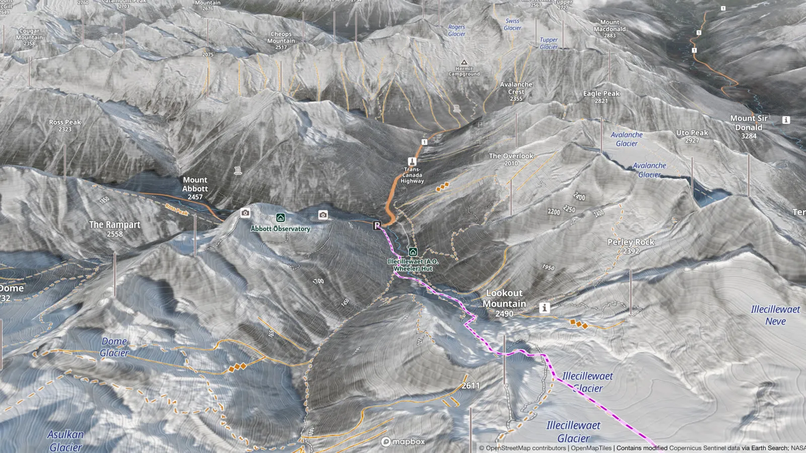
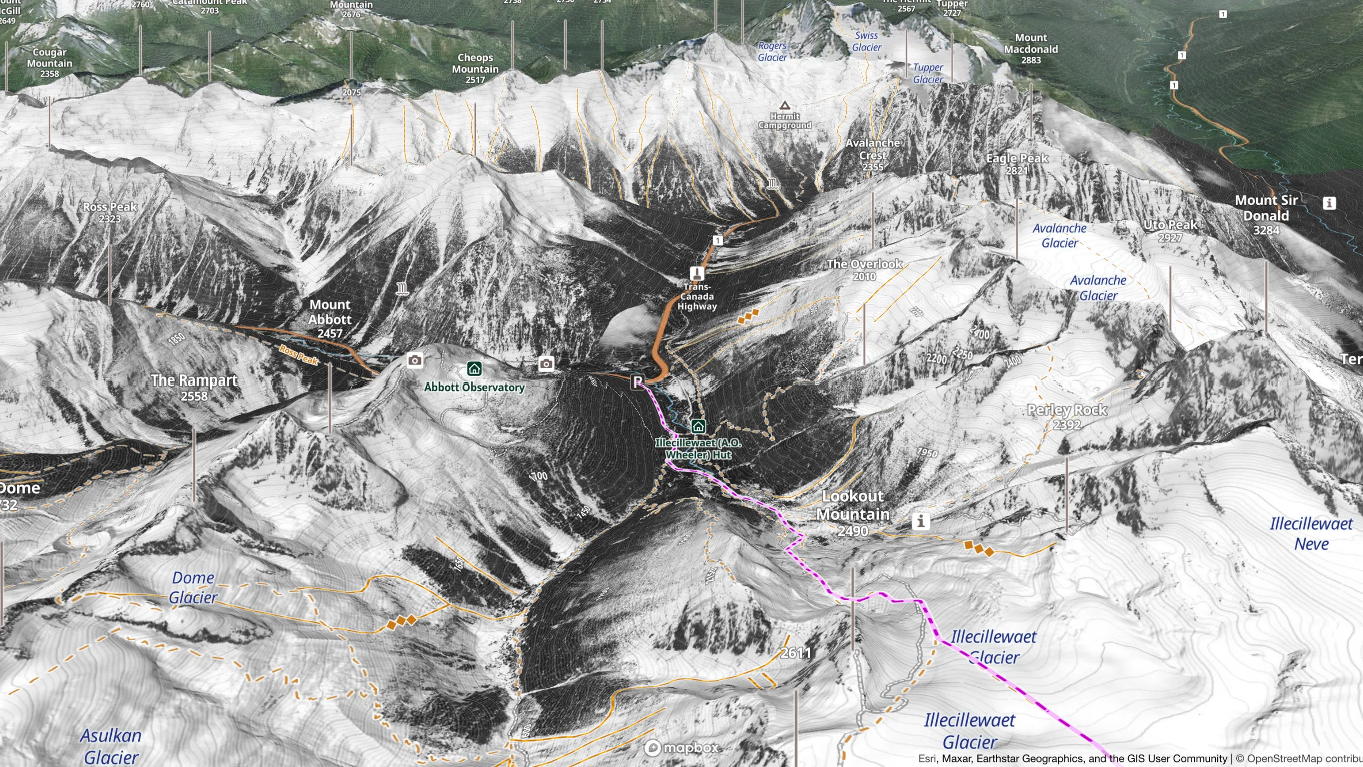
- See it under snow on Winter (beta): the most wintry picture of each place, even an older one, so you see how the terrain looks under snow, not how it looks today. In 3D it makes a high-resolution winter map. It has good coverage in British Columbia, Alberta and Japan, and in some places in Europe, with the Mont-Blanc massif next. Elsewhere, including parts of the Alps, you see the regular imagery: set Recent Imagery to a winter month for a lower-resolution winter view.
- Check this month's snowline on Recent Imagery before you go. It's current but blurry, and hungry: for the same area it downloads two to nine times the data of Maxar, without the detail. On mobile data, check the snowline, then switch back. Clouds and gaps can remain, and a snow coverage layer is coming soon.
- Take Maxar, Mapbox or Winter offline, in HD when you can (2 to 3× the space): see Offline satellite maps below.
Why not one layer for everything?
Sharp imagery and recent imagery come from different satellites. Sentinel-2 photographs every place every five days, at 10 m a pixel: always fresh, but too coarse to read a slope, since a feature smaller than a pixel may not show at all. The sharp layers are stitched together from pictures taken on different dates, so they are older, and a sharp winter picture exists only where a satellite happened to catch one. Out in the terrain, a sharp winter picture, even a ten-year-old one, tells you more than a blurry fresh one.
Compare summer and winter imagery
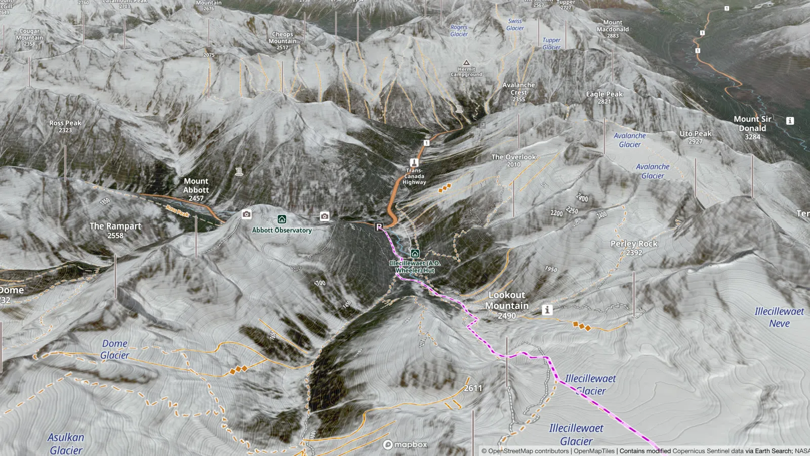
Snow hides the ground. Look at the same slope in summer imagery, then in winter, and you see what lies under the snow you will ski. With Recent Imagery you can pick the months yourself: August and February of the same year, say.
- Cliff bands and terrain traps. Cliff bands, rock bands and gullies, details the topo map often doesn't show, stand out in summer imagery and are easy to miss under snow. So does how tight a couloir is. avalanche.org counts them as terrain traps, features that "amplify the consequences of getting caught in an avalanche", and advises choosing runouts free of them.
- Old avalanche paths. A classic avalanche path shows in summer as a treeless strip down the mountain, with mature trees marking the edges of the flow. Not every path shows this clearly, so turn on the slope angle layer too: avalanche.org calls slope angle "the most reliable way to identify an avalanche path". More: Slope Angle Map
- Glaciers. In a late-summer month the glacier is bare ice; a recent month shows how filled in it is now. A white glacier in the picture says nothing about the snow bridges over its crevasses.
- Tree cover. High-resolution imagery shows how dense the forest is, so you can plan the way up through the open sections.
- The snow itself. The Winter layer shows the same slope snow-covered, so you can see how the terrain you studied in summer looks in winter.
All of it works in 3D: a 3D satellite map you can turn and compare from any side. More: 3D Maps
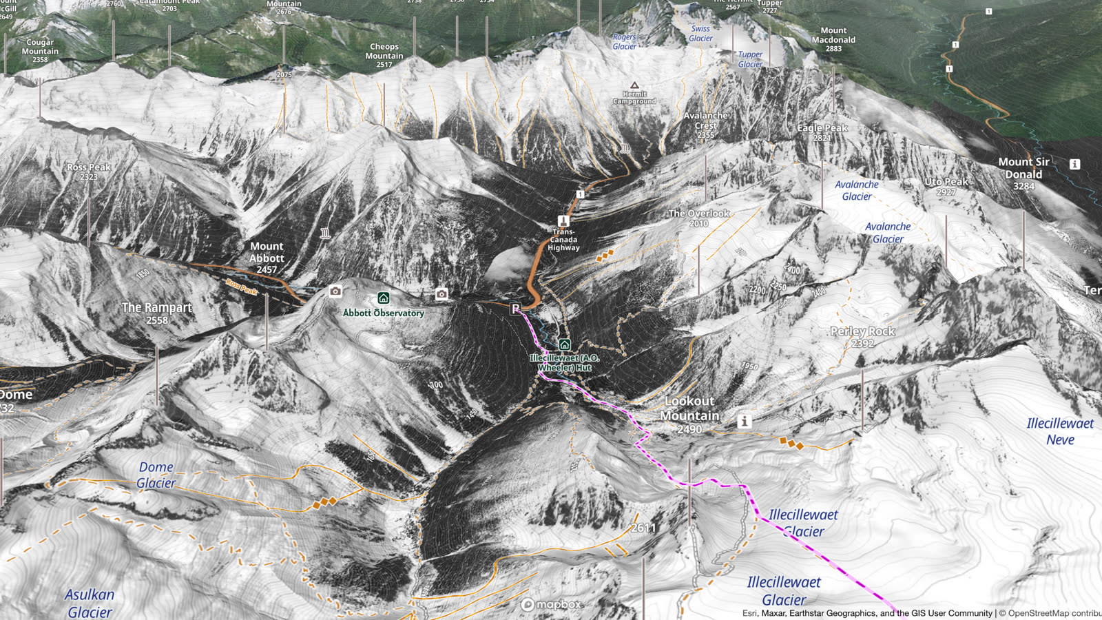
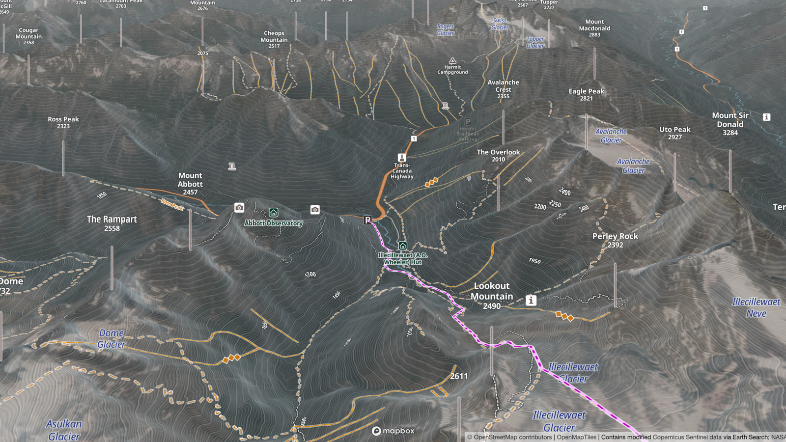
The winter pictures show the snow as it was on the day each one was taken, not today. For today's conditions, read the avalanche forecast, which Outmap shows wherever one is published.
See the snowline
Early season, how low has the snow come down, and can you get in and ski yet? Late season and spring touring, is there still snow on the approach, and can you ski back to the car or out the drainage? Recent Imagery answers that before you go, almost anywhere: Sentinel-2 photographs all land between 56° south and 82.8° north, and the layer is refreshed daily.
Pick a month and set it against the same month in another year: the historical satellite imagery goes back to 2015, so you see at a glance whether this year's snow reaches lower or higher. If clouds hide your slope, choose a clearer month.
It shows where the snow is, not how deep it is: covered is not the same as deep enough to ski. And a 10 m pixel can look white over patchy snow, so check narrow drainages and forest on a sharp layer too.
How to turn it on in Outmap
It works the same in the app and in Outmap Web at outmap.pro/maps, once you're logged in:
- Open the Layers panel.
- On the Basemaps tab, choose Satellite.
- Under Satellite Imagery, pick Maxar, Mapbox, Winter Beta, National Imagery or Recent Imagery.
- Leave Contour lines on to see them over the imagery.
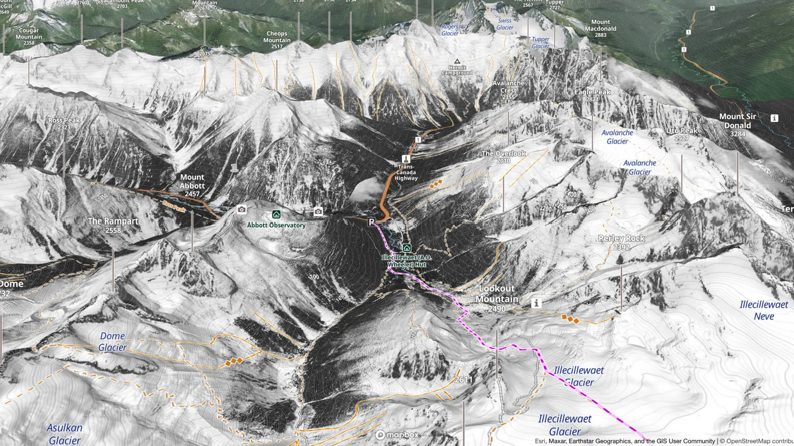

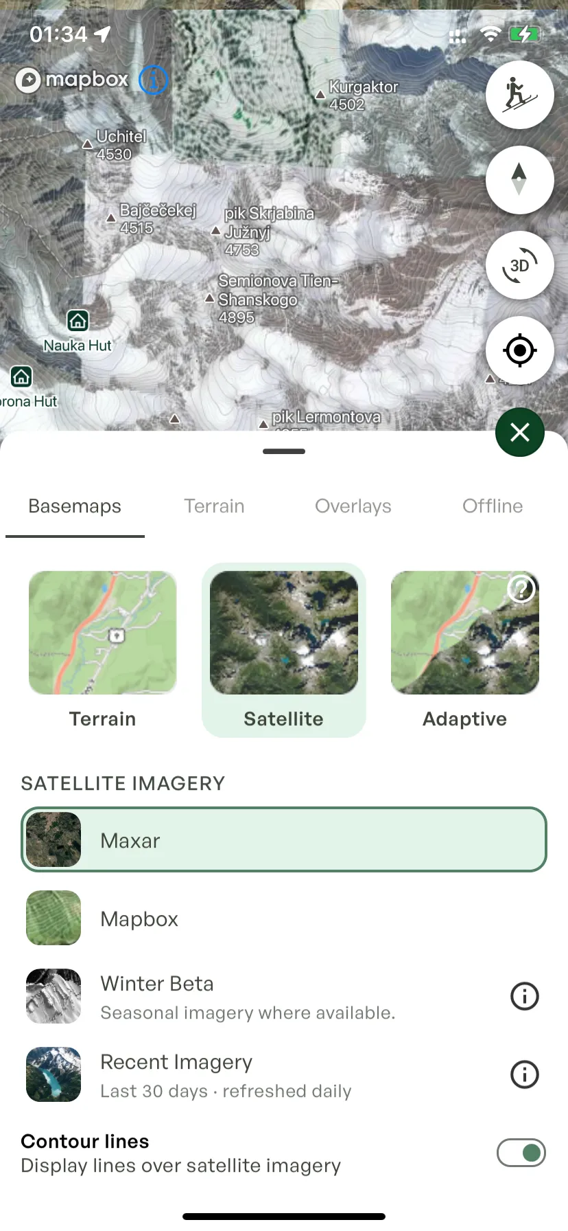
The third basemap, Adaptive, switches to satellite imagery when you need it most: when you tilt the map to see a mountain, and when you zoom in close for more detail. It's part of Pro too.
Offline satellite maps
Offline maps come with Outmap Pro, in the app for iPhone and Android (not in Outmap Web). Open the Layers panel, go to the Offline tab and tap Download map, then move the map until the box covers your area. The download holds:
Satellite imagery comes on top, as Satellite or Satellite HD. Here's how much each step adds to the one above:
Recent Imagery and National Imagery are online only.
For scale: the steps are the app's own estimates around Rogers Pass, where an area of 10 × 10 km is about 80 MB as Topo only. Sizes depend on the place and the area you frame, and the app shows the size before you download.
Our advice: take HD when you can. Plain Satellite is for when you need a bigger area in the same space, such as a route of several days.
Ski routes from Outmap's guidebooks
Outmap's guidebooks put ski routes curated by experts on the same map, over any imagery, and they download with your offline maps. The routes come with their authors' notes: season, conditions, the terrain and its hazards.
Open one and look it over on satellite imagery before you go. The Bugaboos to Rogers traverse, which ends at Rogers Pass, is in Charlie Boscoe's Great Canadian Ski Traverses, with five more: Wapta, Bow Yoho, Spearhead, Garibaldi Neve and Bonningtons. Thomas Kakatsakis wrote Mount Rainier Ski Descents and Cascade River Ski Loops, and there is Mount Washington. Guidebooks are in beta, with more regions coming. Browse the guidebooks
Frequently asked questions
Yes. Outmap lays satellite imagery over its 3D terrain on iPhone, Android and Outmap Web: Maxar, Mapbox, Winter and Recent Imagery. 3D is free; satellite imagery comes with Outmap Pro.
Outmap Pro costs $4.99 a month billed annually, or $7.99 a month month to month, with a 7-day free trial.
Yes, with Outmap Pro, from five providers: Maxar (high-resolution), Mapbox, a snow-focused Winter layer in beta, National Imagery, the highest resolution available for each place, and Recent Imagery, Sentinel-2 from the last 30 days or any month back to June 2015.
Yes, with Outmap Pro, in beta: high-resolution, snow-focused imagery with good coverage in British Columbia, Alberta and Japan, and in some places in Europe. Where it does not reach yet, including parts of the Alps, you see summer imagery; the Mont-Blanc massif is next. Imagery shows the snow on the day it was taken, so check today's conditions in the avalanche forecast.
Yes, with Outmap Pro, in the Outmap app for iPhone and Android. Download a region before you go and it keeps the topographic map, hillshade, contour lines, the terrain layers, guidebooks and satellite imagery from Maxar, Mapbox or Winter, so they all work without cell service. Your routes and waypoints are always on your phone, and you stay logged in. Recent Imagery and National Imagery are online only.
It varies by place. For each place the Winter layer shows the most wintry picture there is, even an older one, so it shows how the terrain looks under snow, not this season's snow. For this month's snowline, use Recent Imagery.
Yes, with Outmap Pro. Choose the Satellite basemap, then Recent Imagery: Sentinel-2 imagery from the last 30 days, refreshed daily. It shows how low the snow reaches, not how deep it is.
Try satellite imagery in Outmap
Read the terrain in your browser, then take it offline on your phone before you lose signal.